Blantyre
Blantyre is Malawi's centre of finance and commerce, and its second largest city, with an enumerated 800,264 inhabitants. It is sometimes referred to as the commercial and industrial capital of Malawi as opposed to the political capital, Lilongwe. It is the capital of the country's Southern Region as well as the Blantyre District.
Blantyre was founded in 1876 through the missionary work of the Church of Scotland. It was named after Blantyre, South Lanarkshire, Scotland, birthplace of the explorer David Livingstone. The site was chosen by Henry Henderson, who was joined there on 23 October 1876 by Dr T. T. Macklin and others. Dr Macklin took over the leadership of the mission and began the work of building; but it was not until 1878 that the first ordained minister, Rev. Duff MacDonald, joined the mission. The original missionaries, for various reasons, faced local opposition and three of them were recalled.
From 1881–1898 the mission was run by David Clement Scott, who was famous not only for building the St Michael and All Angels Church, Blantyre, between 1888 and 1891, but also for his Encyclopaedic Dictionary of the Mang'anja Language, which was enlarged and completed by Alexander Hetherwick. The church was famously built by a team of local workmen with no knowledge of European architecture or building techniques.
Alongside the mission a commercial trading company was established. The Livingstonia Central Africa Trading Company, renamed the African Lakes Corporation in 1878, was founded in Glasgow in 1877. In 1881, it moved to Mandala, not far away on the other side of the River Mudi. The company's original base in Blantyre, Mandala House, still exists and is a National Monument and the oldest building in Malawi.
Blantyre's historical importance is rivalled by no other Malawian city. It has many historic and cultural heritage resources, which constitute a vital part of the city and are crucial to its identity, cultural and social well-being and attractiveness to business and tourism. It became a British consular station in 1883 and attained municipality status by 1895, making it Malawi's oldest municipality. By the time of World War I, Blantyre had a diverse population with Africans from neighbouring districts as well as South Asian traders.
The city's status as Malawi's centre of commerce and industry began through its role as a centre for colonial trade in ivory. Thus, Blantyre quickly established itself as a crossroads for trade in Southern Africa. Today the city is Malawi's main manufacturing centre for activities including shoe manufacturing, corn (maize) milling, brewing, soft drink production, baking, printing, and tobacco manufacturing.
From 1876 to 1905, urban development in Blantyre was confined to three distinct areas within 2 km of each other: Blantyre Mission, Mandala (European commercial venture), and the government zone and commercial centre triangle marked by Haile Selassie Road, Glyn Jones Road and Hannover Street. In Limbe development started in 1906 following the establishment of the Shire Highlands Railways Company headquarters and repair and servicing facilities and Imperial Tobacco Group (ITG) packaging and tobacco grading factory nearby. As a result of the establishment of these large operations, easy accessibility and flat topography, Limbe experienced a development boom of Indian wholesale and retail shops. By 1910 Limbe town surpassed Blantyre town. Low- and medium-density housing for the European and Asian staff was in Mpingwe, ITG and Mudi in Limbe and in Mount Pleasant, Sunnyside, Namiwawa, Kabula and Mandala in Blantyre. The Indian shops included accommodation at the rear or on the top floor. High-density housing for the African workforce was far away except the Chiwembe compound in Limbe.
The development history of Blantyre was principally dictated by piecemeal un-co-ordinated development as a result of individual and interest group decisions relating to evangelism, commerce, farming, industry and administration.
Urban development in Blantyre was further stimulated by the construction of the railway. In 1956 it was merged with its sister city, Limbe (11 km east, founded in 1909), to form one city. Here, it became the "headquarter of Malawi (then Nyasaland) Railways."
Blantyre City has a total of eight National Monuments, mostly buildings of historic importance. The City Assembly has nominated two sites for designation as National Monuments and another 23 sites for investigation with regard to their eligibility for designation as national and local monuments.
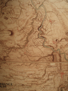
Map - Blantyre
Map


Country - Malawi
 |
 |
| Flag of Malawi | |
In 1891, the area was colonised by the British and became a protectorate of the United Kingdom known as Nyasaland. In 1953, it became a protectorate within the semi-independent Federation of Rhodesia and Nyasaland. The Federation was dissolved in 1963. In 1964, the protectorate was ended: Nyasaland became an independent country under Queen Elizabeth II, and was renamed Malawi. Two years later it became a republic. It gained full independence from the United Kingdom, and by 1970 had become a totalitarian one-party state under the presidency of Hastings Banda, who remained in this role until 1994. Malawi has a democratic, multi-party republic headed by an elected president. Lazarus Chakwera of the Malawi Congress Party led the Tonse Alliance grouping of nine political parties and won the court-mandated Presidential Election rerun held on 23 June 2020 after the May 2019 Presidential Election was annulled due to electoral irregularities. The country's military, the Malawian Defence Force, includes an army, a navy, and an air wing. Malawi's foreign policy is pro-Western. It maintains positive diplomatic relations with most countries, and participates in several international organisations, including the United Nations, the Commonwealth of Nations, the Southern African Development Community (SADC), the Common Market for Eastern and Southern Africa (COMESA), and the African Union (AU).
Currency / Language
| ISO | Currency | Symbol | Significant figures |
|---|---|---|---|
| MWK | Malawian kwacha | MK | 2 |
| ISO | Language |
|---|---|
| NY | Chichewa language |